From Derbyshire to Scotland and Back Again – in a Van
A 7 day itinerary that isn’t the North Coast 500.
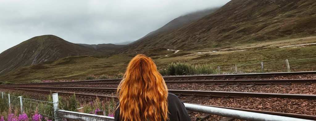
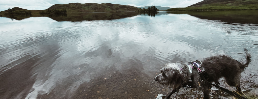
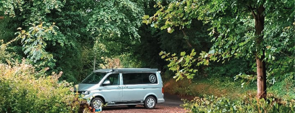
I can hardly believe it’s been over a year since we packed up a campervan and set off on an unforgettable adventure through Scotland. Exploring the rugged, untamed beauty of Scotland’s winding roads, towering mountains, and rocky harbours had long been a dream of mine, and in 2023, we finally made it happen—dog and all. Gwen, our beloved rescue pup, joined us for this epic journey, adding her own unique challenges and joys to the experience.
Months of meticulous planning went into crafting our itinerary. I poured over maps, purchased lots of guides, compiled PDFs, scribbled notes, and bookmarked countless recommendations for places to eat, scenic stops, and hidden gems. I even binge-watched hours of YouTube videos for inspiration. And of course, we went off route and found things along the way to go an explore, including a stay in a cabin for one night.
One important note before we dive into the details: Gwen is a reactive rescue dog who struggles around other dogs. If you’re familiar with Scotland in the summer, you’ll know it’s a hotspot for tourists, with the most popular destinations often teeming with people and their furry companions. For this reason, our itinerary focuses on lesser-known, quieter spots that are every bit as breathtaking.
This was truly the trip of a lifetime, and I can’t wait to share it with you. From the awe-inspiring landscapes to the cozy nooks we discovered, join me as we relive the magic of our Scottish van adventure …
Day 1: Derbyshire to Alnwick
Our journey began right from our doorstep in Derbyshire, setting the stage for an adventure we wanted to savor every step of the way. With our dog accompanying us, we made sure to plan for a few essential stops en route to Scotland. There was no rush—this trip was all about enjoying the experience and soaking in every moment. On day one, we nearly made it to Scotland, ending the day in Alnwick after a few delightful stops along the way.
Stop 1: Ledsham Bank Nature Reserve (1hr 26mins travel time)
What3Words: tracks.tidal.storming
Ledsham Bank is a lovely little Nature Reserve tucked away in a magnesian limestone valley near Castleford, West Yorkshire. According to the Yorkshire Wildlife Trust, Ledsham Bank supports incredible plantlife, including pyramidal and common spotted orchids, autumn lady’s tresses, hoary plantain, yellow-wort, and dyer’s greenweed – rare in Yorkshire. We had a quick stop off here to let the dog out for a wee and to stretch our legs before jumping back in the van to carry on with our route to Alnwick.
Stop 2: Wharnley Burn Waterfall (1hr 36mins)
What3Words: masts.announce.thighs
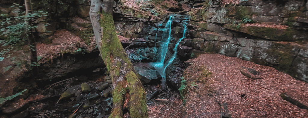
This is a magical little waterfall located in Allensford near Consett. A short walk from the carpark, and you turn a corner and stumble upon a world made for fairies. For any booklovers our there, it was like stepping into the faerie lands of Prythian from ACOTAR. The waterfall is gorgeous (and to be honest I was a little bummed I didn’t bring my swimming costume because it was a beautiful wild swimming spot!) It honestly feels that if you are quiet enough, fairies and woodland creatures will pop out to say hello.
Parking is available at Pemberton Rd, Allensford, Consett DH8 9BA. Head towards the River Derwent and walk along the river towards Watergate Burn. You will meet Wharnley Burn Waterfall along the route. I found the Fabulous North website really helpful in terms of finding the waterfall and where to park. The carpark is huge and next to a great dog walking spot and river, which we also explored.
Stop 3: Alnwick and our park up for the night … sort of (1hr 8mins)
What3Word: unwind.digitally.propelled
Our plan was to park in a charming little lay-by that offered stunning views and a small waterfall just a short walk away. When we arrived, it was every bit as beautiful as I had imagined. However, the wind was relentless, and being perched right on the cliff edge made it feel a little precarious. We managed to enjoy our dinner there—pork chops and salad, in case you’re curious—but ultimately decided to move to a lower, more sheltered spot for the night. I couldn’t shake the thought of us toppling over if the winds picked up! That said, I can wholeheartedly confirm it’s a breathtaking spot to spend a night—just maybe not in a gale!
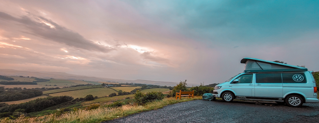
After a quick Google search and a look on Park 4 Night, I found a carpark just 5 minutes drive away where we spent the night. The carpark can be found at (NE66 1DH) Alnwick – Howling Lane. It was a large space, free, and situated right at the hear of Alnwick. There were around 5 vans there during our stay, but it was very quiet. There are no facilities, but toilets can be found a 15min walk away in the town itself. I’d recommend this carpark for a simple stay.
Day 1 total travel time: 4hrs 20mins (214 miles)
Day 2: Alnwick to St Abbs Harbour
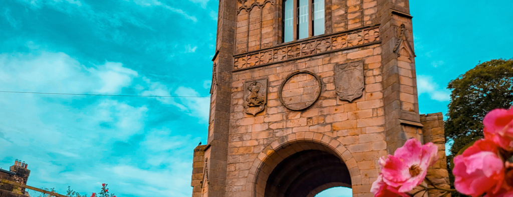
The sun was shining, we had successfully—and happily—survived our first night in the van. After a leisurely stroll around Alnwick and a quick pit stop for a Greggs bacon cob (a must every now and then!), we hit the road again, ready for the first stop of day two. It wasn’t part of our original itinerary, and let’s just say things didn’t quite go as planned…
Stop 4: Craster (17mins)
What3Words: destroyer.single.atoms
When I was looking at the planned route for the day, I noticed a small village nearby, by the sea, and to be honest I couldn’t believe I hadn’t spotted this before during my many months of planning! So I quickly added this to our route, and off we went!
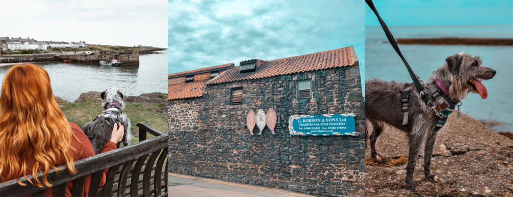
Craster is an unspoiled fishing village, and the first thing I noticed when stepping out of the car was the smell of Kippers, which I later found out comes from L. Robson & Sons kipper smokehouse! Unfortunately, I wasn’t able to try some, (too full on Gregg’s Bacon cob, doh!) but if you’re visiting Craster I recommend giving them a try – and a little titbit: they’re reputedly popular with the British Royal Family! We enjoyed a mooch around, took in some great sea views and Gwen enjoyed a paddle in Queen Margaret’s cove too. You can actually spend a full day at Craster with lots to do including caves, Egyncleugh Tower and The Mick Oxley Gallery. A great source of information is Visit Northumberland’s Website.
Stop 5: North Shore – Holy Island (46mins)
What3Words: hips.spoiled.intruded
Holy Island is a very small island that holds pubs, cafe’s seafood stands, icecream vans, coastal Lindisfarne Castle and the ancient Lindisfarne Priory. When the tide is going down, the sea reveals a causeway; a path from the mainland to the island called ‘Pilgrim’s Way’. You can drive over to Holy Island (but you need to check the tide!) as the road is only drivable when the tide is out. You can check the tidal times here, and in summer there is a good 7 hour window for driving to and form the island.
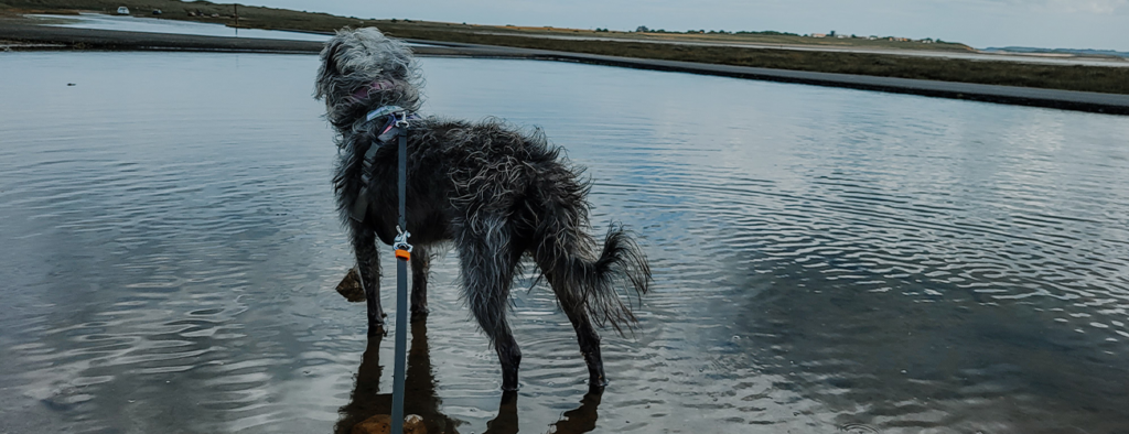
The drive over was so much fun, with the sea either side of us as our van adventured over the sandy beach. However, Holy Island was a tourist hot spot, and easily the busiest place we visited during our stay. Despite the crowds, we parked up and ventured towards Lindisfarne Castle, but unfortunately Gwen was getting really stressed with the amount of people (and dogs!) so we had to turn back around without getting to view the castle. When leaving the Island, we did find a quieter spot beside the sea, with only one other car nearby, so we decided to stop and Gwen enjoyed a paddle! We were planning to spend most of the day here, but actually only spent an hour(ish). I’d recommend Holy Island for a visit if you don’t have an anxious dog like we do, as there’s lot to see and do and it’s a unique spot. But alas, these things happen and it was nice to see Gwen go for her first ever paddle!
Stop 6: Burnmouth Village (32mins)
What3Words: cricket.ultra.grad
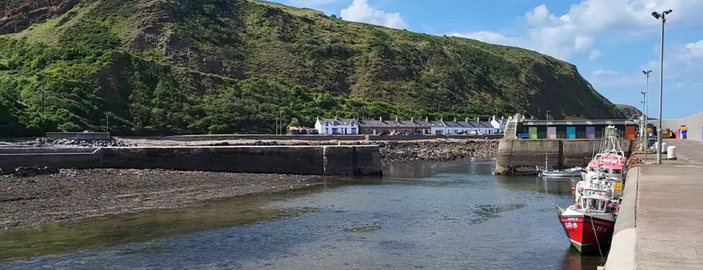
Burnmouth is a small fishing village with a harbour on the Berwickshire coast, north-west of Berwick-upon-Tweed. Burnmouth lies at the point where a burn slices through the high cliffs lining this coast en route to the sea. The village is split over two levels, Upper Burnmouth and Lower Burnmouth. Nestled at the foot of the Berwickshire Coast cliffs is Lower Burnmouth. Lower Burnmouth is home to a small but mighty fishing harbour and foreshore.
This was a great place to stretch our legs (Gwen’s included!) and we had fun exploring the hamlets of Partanhall, Cowdrait and Ross. It was as quiet as a mouse here, with just the sea and gulls in the background and we didn’t see a soul! There’s a dreamy row of 14 picture-perfect cottages, 3 smoke-houses and a colourful line of townhouses picturesque along the seafront. As I wondered along the pathway, I couldn’t help but fantasise about a different life with sea views and fish suppers.
Stop 7: St Abbs Harbour and Night 2 Park Up (15mins)
What3Words: parrot.imply.training
We were in for an absolute treat with this stop and park up! First things first, a little warning if you plan to travel to St Abbs Harbour: it’s an incredible steep and winding one track road to the harbour, but it’s so worth it!
St Abbs Harbour is a quaint and picturesque fishing harbour in the heart of the Berwickshire Coast. It has recently become popular after featuring as Thor’s town, New Asgard, in the Avengers: Endgame!
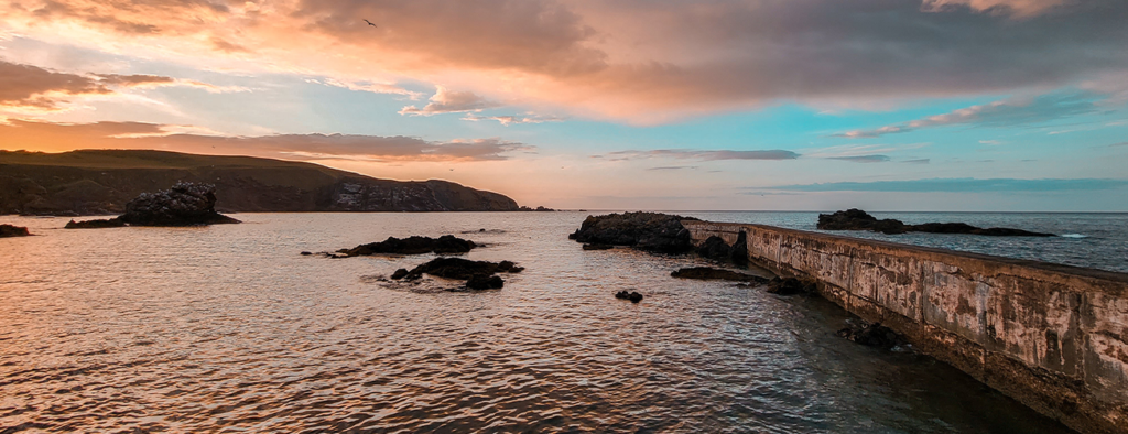
The harbour can be found beside the St Abb’s Head National Nature Reserve, home to an internationally important seabird colony. According to Visit Berwickshire Coast, you can also spot seal pups on the beaches in the autumn as well as dolphins and minke whales. The remote fishing village of St Abbs has a rugged setting, surrounded by jagged cliffs, and old fishermen’s cottages tumbling down to the surf-battered harbour.
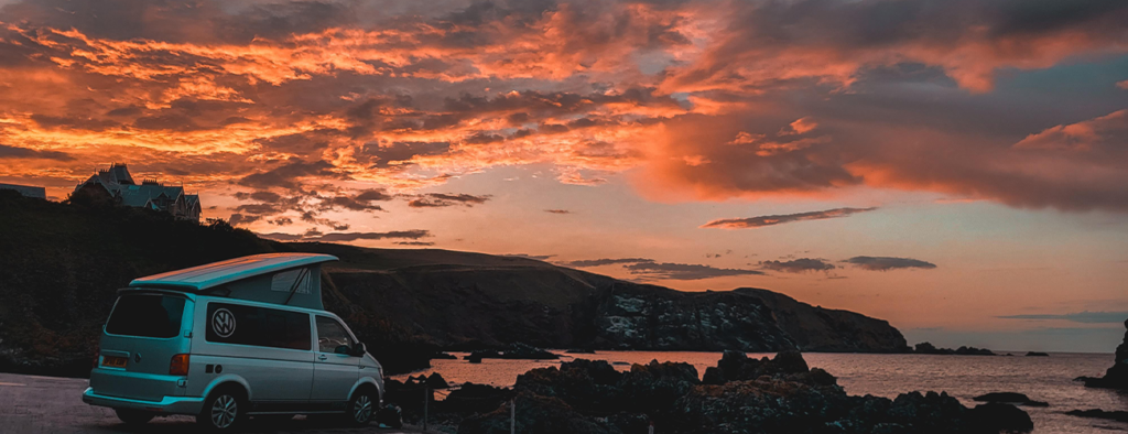
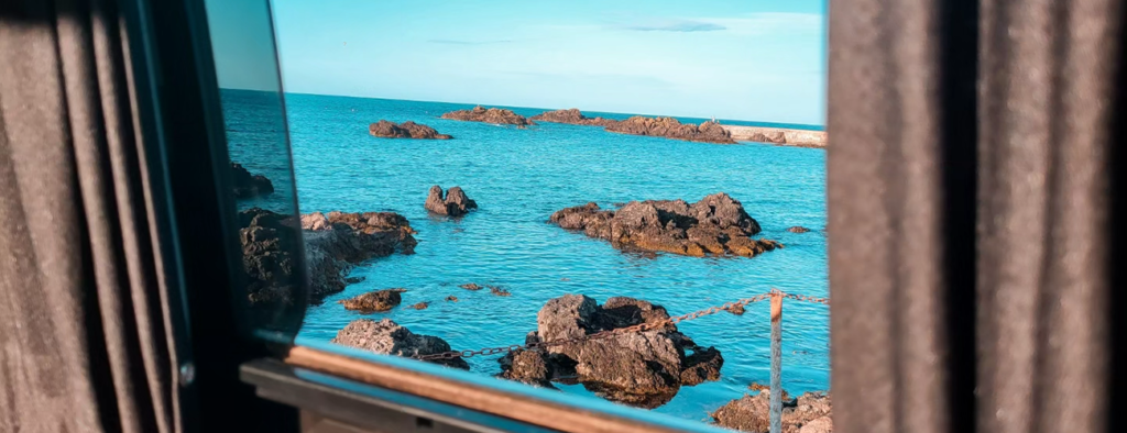
To park overnight it will cost you £10, which you post through the harbour master’s office door. There are toilets and showering facilities too. But what makes this an incredible overnight spot is the sea views, cafe just meters away, the beautiful harbour and glorious sunsets. We set up camp and chose to explore the beach with Gwen- we were the only ones here for the most part!
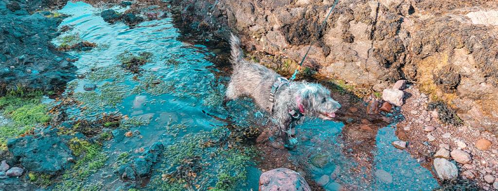
It’s a relatively small cove and the tide was drawing in as we arrived, so we did some rock scrambling and Gwen got her paws wet (she loves water!) It was then time to make some dinner, and we knew this was the prefect location for a BBQ on the beach! BBQ lit, burgers on, deck chairs out, and the sound of waves to set the mood.
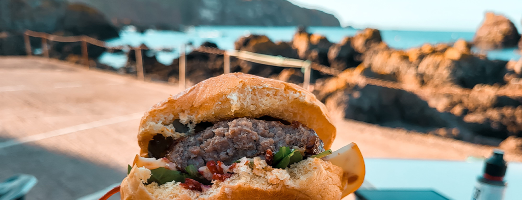
After a beer and a burger, I went in search of the showers before having a wander around the beautiful harbour. As I mooched around, the sun just started to set, and I had a glorious walk amongst the crab cages, fishing tackle and boats bobbing in the water.
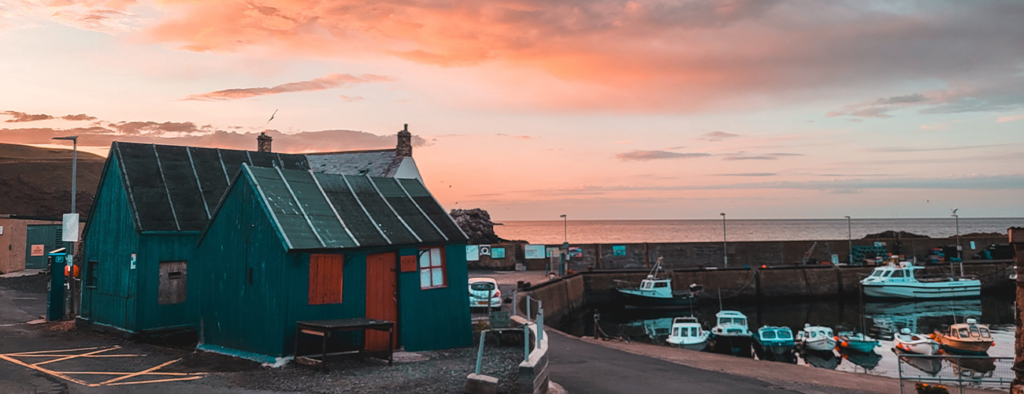
We even managed to catch a rainbow!
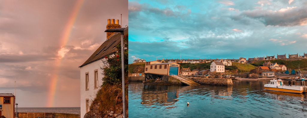
After watching a stunning sunset and enjoying a few more drinks, we settled in for the night, falling asleep to the distant calls of gulls and the soothing sound of the sea gently lapping against the rocks. This spot was undoubtedly one of the highlights of our trip—a truly perfect park-up made even better by the amazing weather we were fortunate to have.
Day 2 total travel time: 1hr 18mins (214 miles)
Day 3: St Abbs Harbour to Kinross
Day 3 was a jam packed day, with lots of stops, ice-creams, beaches and cliff edge walks. We woke in St Abbs Harbour to more beautiful weather, so decided to take advantage of this and have a morning walk to Starney Bay.
Stop 8: Starney Bay (6minute walk there)
What3Word: endings.foggy.slimmer
Walking boots laced up, the dog fed and watered, and off we went in search of Starney Bay. The walk to find these scenic views only took 6 minutes, and was a small up-hill climb to the cliff edge. As soon as the trail reaches the coastline at Starney Bay, the jagged cliffs and rock formations take centre stage.
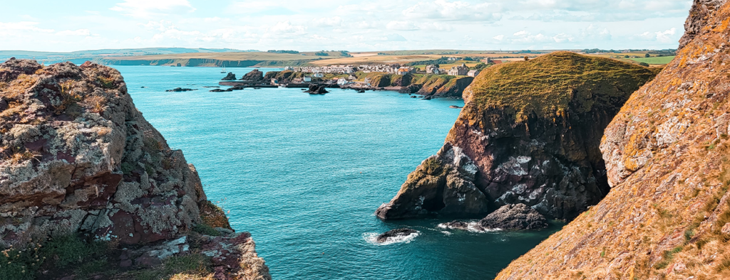
From here you can walk to St Abb’s Head Lighthouse. Unfortunately due the amount of other dogs and people, we decided not to continue further which was a shame, but breakfast was calling!
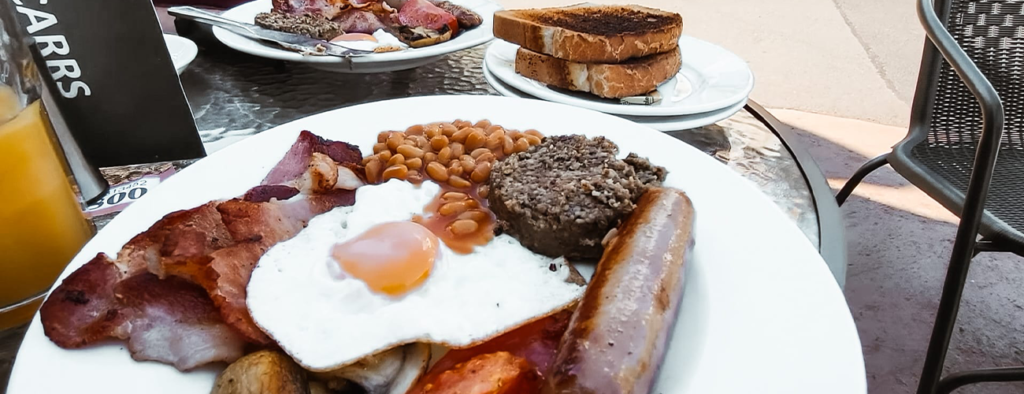
On return to St Abbs Harbour there were a few more people milling about compared to the previous evening. From fishermen, to early morning divers, locals and those visiting the cafe for breakfast – all were enjoying what St Abbs Harbour has to offer. We found a spot outside Ebbcarrs Cafe so we could eat our breakfasts with the view of the sea and harbour. The cafe can be found on the harbour front boasting fresh local seafood, home baking and local ales. We ordered our fry-ups, the dog got a sausage, and I tried haggis for the first time!
Stop 9: Siccar Point (19mins)
What3Words: cobbled.gems.owner
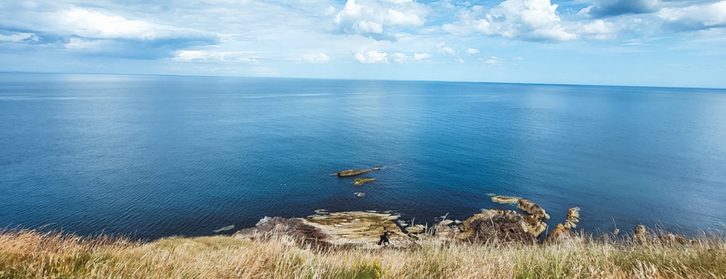
Siccar Point is notable in the history of geology as a result of a boat trip in 1788 in which geologist James Hutton observed the angular unconformity of the point. He wrote later that the evidence of the rocks provided conclusive proof of the uniformitarian theory of geological development; that is, that the natural laws and processes which operate in the universe have never changed and apply everywhere. It made for an interesting spot to pull up, have a longer walk with Gwen and have a look out to sea from the cliffs.
The walk to get to the point takes around 15 minutes across farmland, swerving through cows and it’s worth noting there are warnings about getting close to the edge as it can get slippery. On arrival we enjoyed reading about the history and looking out to sea. It was also a really beautiful (and free) park up amongst the hills and I’d recommend as another overnight spot if you were looking for somewhere to stay in the area.
Stop 10: Cove Harbour (8mins)
What3Words: iceberg.composts.flicked
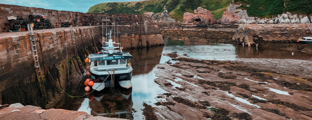
Cove Harbour, a charming, “secret” spot on the coast, it has been a well known spot for fisherman since the 17th century. It’s a fantastic spot to chill, read a book, walk along the beach and watch the boats bob on the tide. The cove is often empty, and is off the beaten track. You find the secret harbour by going through a short tunnel within the hillside, you really wouldn’t know it’s there or have any chance stumbling upon it! You can walk down to Cove Harbour from the quaint hamlet of Cove perched on the clifftop. It has a small but FREE car park for visitors which is open daily. I found these details on how to find the hidden beach really helpful.
We arrived at Cove Harbour with dark sides and we knew we didn’t have long before the sunny part of our trip ended and the rain came in. We managed a short walk along the beach and a little explore of the cover before the rain started to pour and we quickly walked pack up the cliff edge to our dry van.
Stop 11: North Berwick (30mins)
What3Words: bearings.golden.candy
North Berwick is a charming seaside town boasting great beaches and coastal scenery, and the Scottish Seabird Centre. It’s also home to a colourful mix of independent shops, cafes and bars. We weren’t intending to visit North Berwick as we were trying to stay away from the busier stops such as towns. However, we decided to give it a go with Gwen, as we could always get back in the van if it was too busy!
It turns out, it was very busy! haha! But we did manage to take Gwen for a sea swim and had a quick ice-cream before dipping back into the van. I’d have loved to have been able to look inside some of the independent shops as I love a good Knick-knack but it was a pleasant quick trip before moving on to our park up for the night.
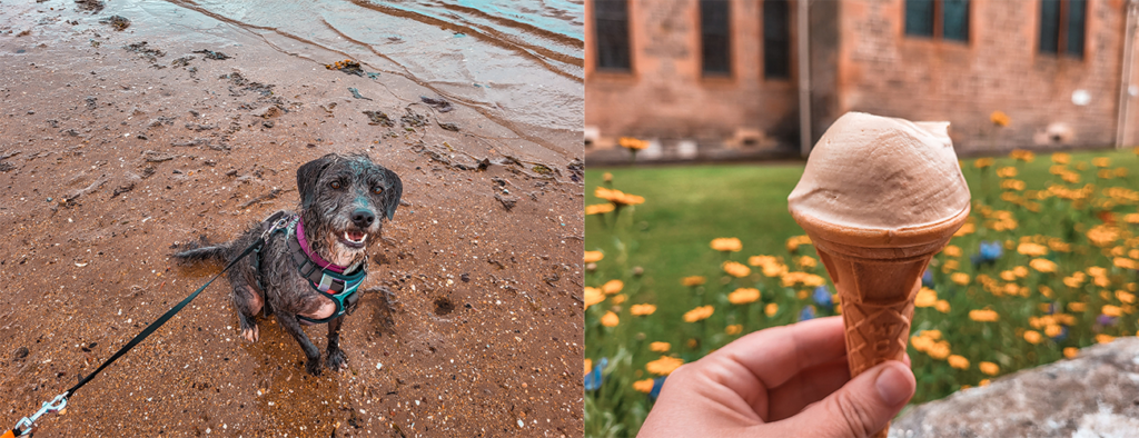
Stop 12: Loch Leven – Our Park Up for Night 3 (1hr 18mins)
What3Words: risky.fancied.states
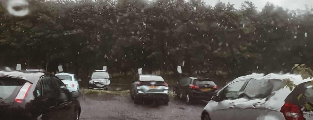
As we were ahead of schedule, we decided to drive on a bit further and deter from our original plan to park at North Berwick Tantallon Terrace. After a another Google Search from the van and checking out some spots on Park4Night (can’t recommend this app enough!), I found our next park up – Loch Leven Nature Reserve. As we drove towards our spot for the night, the rain really started to come down and we knew we were in for a cosy night. We decided to stop near-by for some fish and chips (after visiting so many beaches and coves we were craving a chippy tea!) and reached the Loch Leven Nature Reserve where we paid to park overnight. The price was £15 for an overnight stay with facilities that were open all night.
We weren’t the first to arrive at the Nature Reserve, which was still open, so the car park was fairly busy. However, as the evening wore on, the cars gradually disappeared, and by nightfall, only a handful of vans—about six in total—had joined us. It was a wonderfully peaceful spot. We tucked into our fish and chips as the rain pattered persistently on the roof, then spent the evening reading, playing cards, and hoping for clearer skies by morning.
Day 3 total travel time: 2hrs 26mins (94 miles)
Day 4: Loch Leven to Loch Ericht
From day 4 is where we started to go a little off plan and explore things we found on the way – but that’s what part of van life is all about!
Stop 13: Loch Leven National Nature Reserve
What3Words: comet.donor.sprains
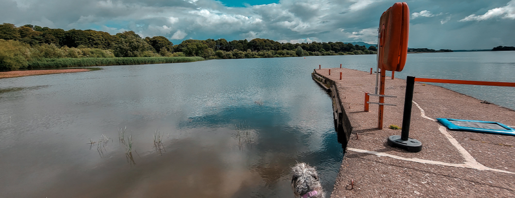
Despite a heavy night of rain, the next morning we woke to blue skies and sun. As we parked at Loch Leven for our overnight stay, it would have been rude not to have a little morning walk around the Nature Reserve!
A huge expanse of open water, Loch Leven is home to more breeding ducks than anywhere else in inland Europe according to Visit Scotland. We enjoyed having a little wander around the loch, there was a huge dog playing field for Gwen, and if we had wanted to stay longer, we might have sampled the cafe or had an ice-cream, but alas, we had a full itinerary and our next stop was calling! You can find out more about the loch here.
Stop 14: The Hermitage & Pine Cone Point Walk (39mins from Loch Leven)
What3Words: slept.dweller.brimmed
This was our first mapped walk of the trip, and I’ll link the walk which can be found on AllTrails here.
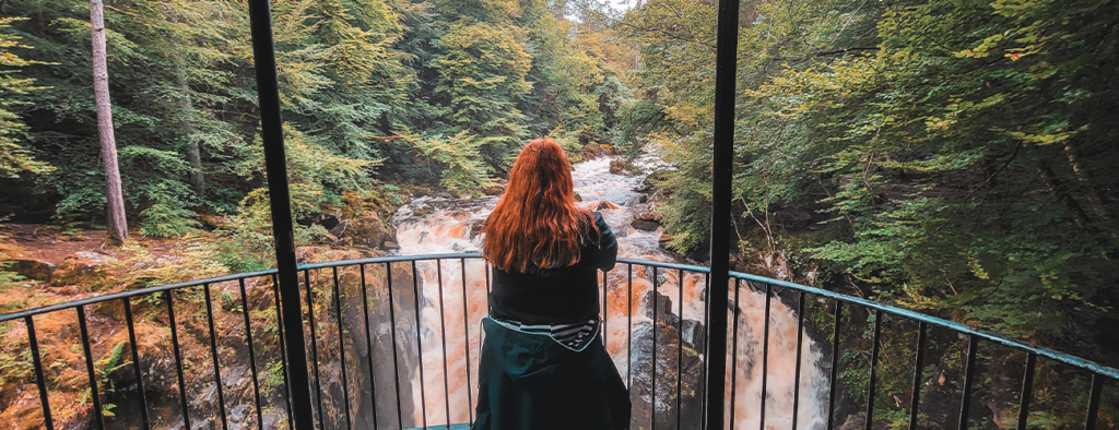
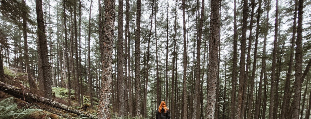
My absolute favourite places to visits are woodlands and forests, so I was incredibly excited for this walk. The Hermitage and Pine Cone Walk is a 2 hour walk in Craigvinean Forest. It includes waterfalls through the woodland and alongside the river Braan. You’ll follow in the footsteps of past notable visitors including William Wordsworth, Queen Victoria, Mendelssohn and J M W Turner as you wander through this magnificent landscape. Giant Douglas firs tower over you as you take the path to the roaring Black Linn waterfall, where the River Braan crashes into the deep, foaming pools below. It was nothing short of breathtaking. Deep in the woods, we got to discover the picturesque 18th- century folly known as Ossian’s Hall, which overlooks the stunning waterfall. It was a truly special walk, and I highly recommend!
Stop 15: Port na Craig (18mins)
What3Words: renewals.familiar.another
On our way to the Falls of Truim, we happened to pass a sign for a village called Port na Craig. We had some time, and we love an unplanned adventure, so decided to give it a try, and we are pleased we did!
We were greeted to a picturesque village in Pitlochry with scenic views of the River Tummel and the surrounding hills. It was quiet and a lovely little spot to explore (even in the pouring rain!). One of the most interesting facts about Port na Craig is that it was once a bustling port that served as a hub for the transportation of goods and people.
We enjoyed a walk around the village, and we did try to have a drink at the local pub; Port-Na-Craig Inn. However they were closed and opened later in the day, so explored the Pitlochry Theatre instead (also where we paid to park for our visit). I enjoyed looking around the gift shop here, and had to buy a little bit of Scottish chocolate for the road.
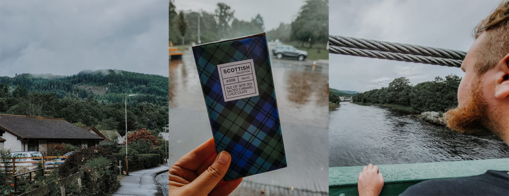
Stop 16: Falls of Truim – with a bonus viewing spot en route! (45mins)
What3Words: paints.geese.counters
The Falls of Truim are a must-visit, easily accessible stop if you’re traveling along the A9 between Dalwhinnie and Newtonmore.
The journey to the falls was just as breathtaking as the destination itself, with stunning roads winding through majestic mountain landscapes. Along the way, there are plenty of lay-bys to pull into, offering perfect spots to take in the incredible views. Trust me—it’s well worth it. See for yourself:
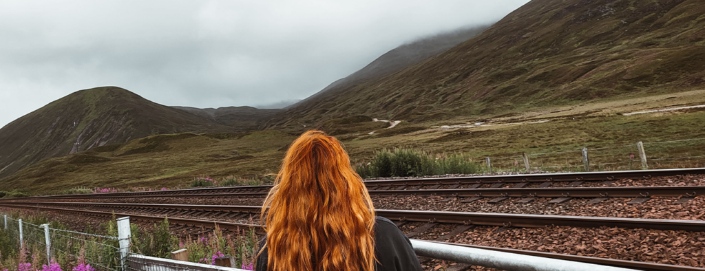
After “oooohing” at the incredible views, we were back in the van and on to our second walk of the day, the Falls of Truim.
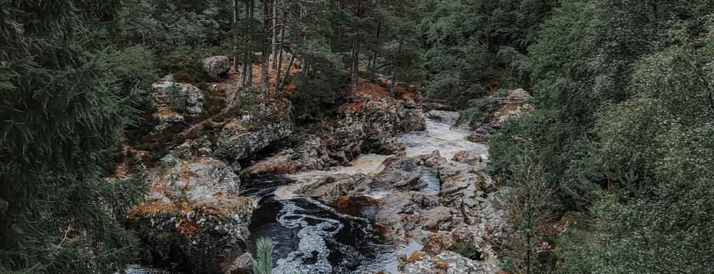
An old road bridge and pine woods make for a characterful setting, with narrow paths on both banks giving access to several viewpoints. The falls are a set of rapids rather than a single drop, with countless potholes and pools carved out by centuries of river erosion.
From the car park, it’s a 5-minute walk to the falls. Head north along a short gravel path, cross the road, and turn left onto a narrower side road leading to the bridge above the falls. For most of the way, a parallel path runs along the right side. From the bridge, a trail follows the north (far) bank, but be cautious of unprotected drops. The south bank also offers excellent views, though it lacks a proper path and has slippery rocks, so extra care is needed. It’s a wonderful walk, and again felt like we were stepping into the world of the fae!
Stop 17: Loch Ericht and our park up for the night (1hr 53mins)
What3Words: cushy.woodstove.miracles
One of our longer drives between stops, we were on our way to our planned park up for the night – Loch Ericht. Loch Ericht is a freshwater loch on the border between Perth and Kinross and the former Inverness-shire, now Highlands Council areas of Scotland. Loch Ericht is the tenth largest freshwater lake in Scotland and has a good reputation for its trout fishing. However we weren’t there to do any fishing, but were on the hunt for a quiet park up with views – and we managed to find one with facilities!
I’ll provide the information for the parking here, it included toilets that were a 10 min walk away and voluntary donations are welcomed to enable the upkeep of visitor facilities. The views were superb, and we enjoyed our stay here. We cooked up some dinner, enjoyed a cuppa tea, did a little bit more reading and settled down for a quiet night in the van.
Day 4 total travel time: 3hrs 28mins (131 miles)
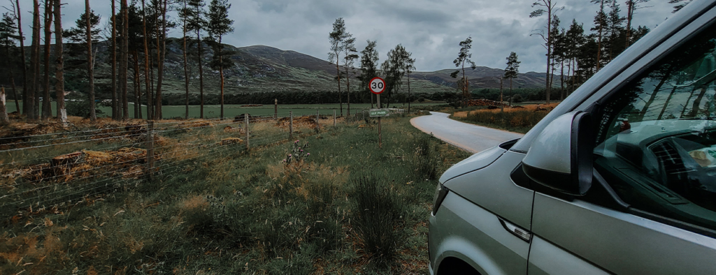
Day 5: Loch Ericht to Glencoe
Day 5 takes us to a few more touristy spots and we went in search of the Loch Ness Monster!
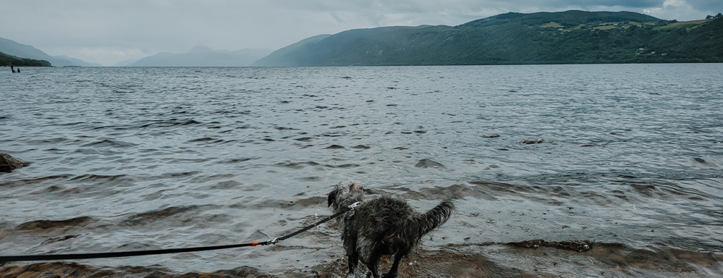
Stop 18: Dores Beach, Inverness (3hrs)
What3Words: worm.swerving.clothed
Dores is a tiny Highland village on the southern shores of Loch Ness, 10 km southwest of Inverness. It has a church, village hall, country pub and – what we were there for – a gorgeous beach.
This historic Loch Ness village dates back to the 1st century. Its name comes from the Gaelic meaning “dark woods”. In search of Nessie, we parked up and began our adventure. Dores Beach is one of the top spots to take in the stunning views of Loch Ness. From here, you can see the length of the famous Loch and understand why it’s a favourite for those hoping to spot Nessie. A visit to Dores Beach pairs perfectly with a circular walk along the shoreline to Torr Point and Aldourie before returning to the village.
To begin your walk, free parking is available near the church in the village. From there, head towards the Dores Inn and make your way down to the beach. Just above the beach, you’ll find a path that leads to Torr Point, offering breathtaking views of the Loch along the way. Continue along the shoreline past Aldourie Pier, then loop back through the woods to return to the beach and the village.
On arrival at the beach, there were lots and lots (and I mean lots) of people (and dogs!) so we made this a very quick pit stop and decided not to complete the walk. Gwen had a quick paddle before she started to fancy her chances at a fight with another dog, so we swiftly left. (I promise that most of the time, Gwen is lovely! But due to her previous life before she ended up at a rescue centre, and then with us, she was mistreated and has a huge problem with other dogs – we’re very careful where we choose to take Gwen and she has a muzzle, but she gets incredibly stressed so we try to stay away from places with lots of dogs). Gwen aside, it’s a truly gorgeous small beach and if your near-by and don’t mind people, go check it out.
Stop 19: Corpach (1hr 37mins)
What3Words: outlast.muscular.microfilm
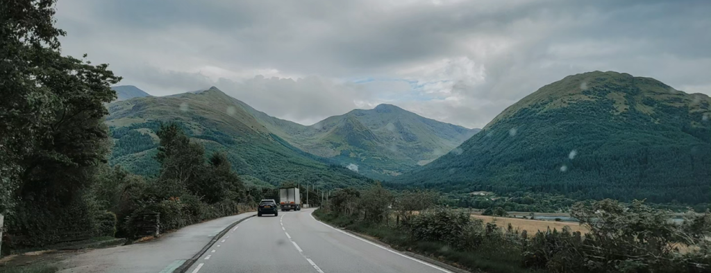
In search of quieter spots, we hit the road and made our way to Corpach, and these roads were STUNNING. We simply had to get out several times to take in some of the dreamy landscapes:
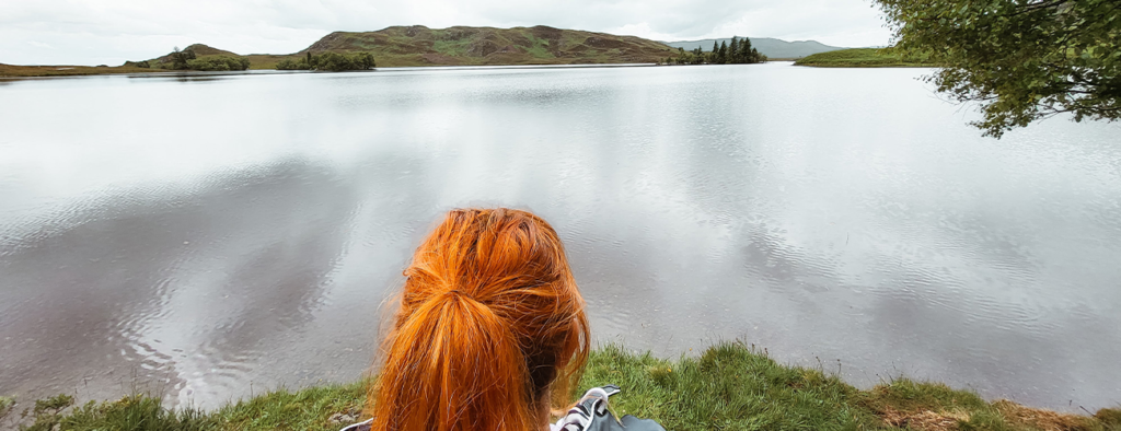
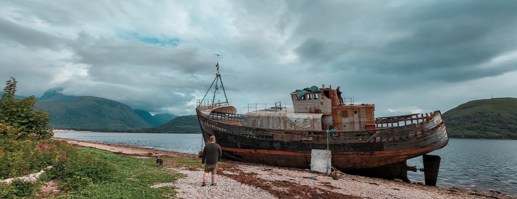
Corpach has two large advantages over its neighbour Fort William, and is less busy. The first is that its frontage on Loch Linnhe is easily accessible and very attractive (and comes complete with the added interest of the entrance to the Caledonian Canal). And the second is obvious when walking the shoreline at Corpach: it offers superb views of Ben Nevis, a mountain largely invisible from Fort William itself. We’d also caught wind the there’s a shipwreck, and as two previous narrowboat dwellers, we were most looking forward in trying to find it!
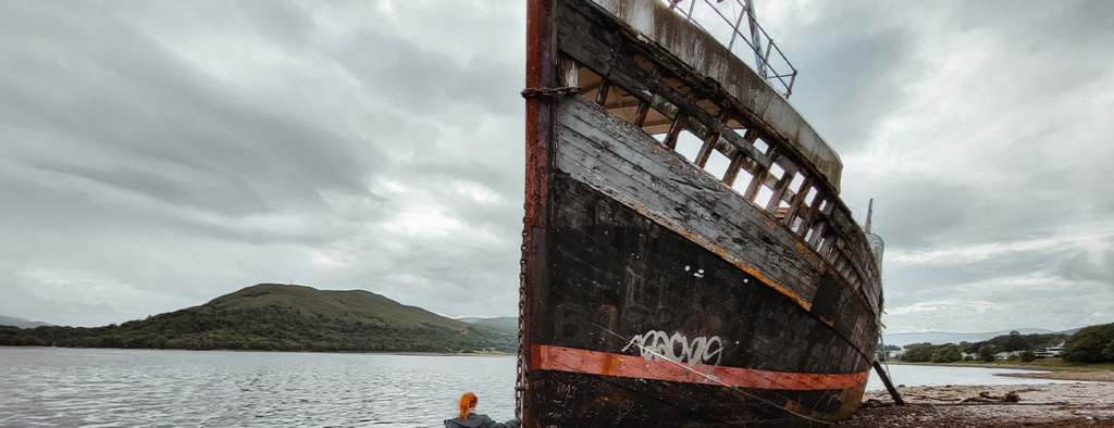
And found it we did! (It’s hard to miss to be honest!) If you want to learn more about the Corpach shipwreck I found this blog by Ella McKendrick super interesting!
Stop 20: Glencoe and our park up for the night (37mins)
What3Words: wager.baffle.forgot
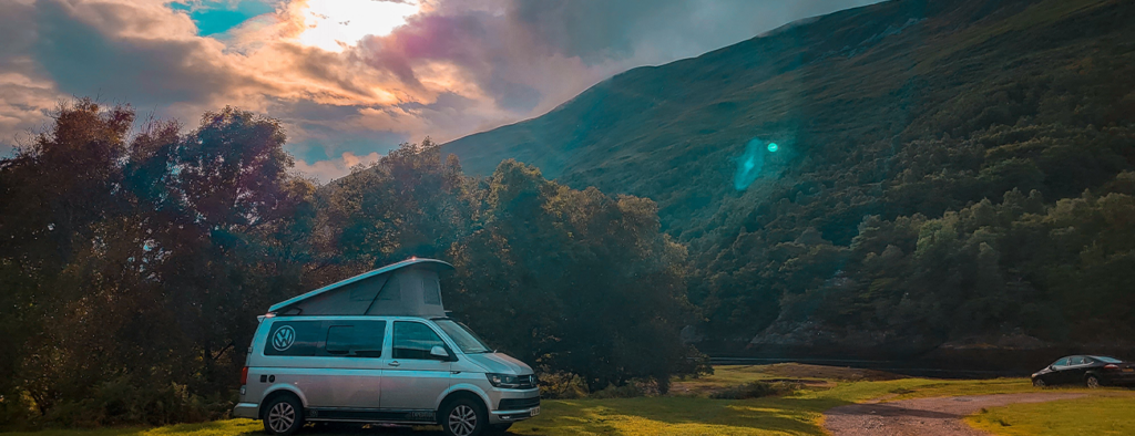
With less stops on day 5, but plenty of driving, we headed for park up for the night. This time, we chose to stay in a campsite so we could take advantage of a hot shower.
We booked into Invercoe Caravan & Motorhome Park and were lucky to get a spot, as on arrival there were only a few pitches left. It’s a beautiful spot, surrounded by mountains and water. The shower block and toilets were spacious, but it was one of the busier overnight stays with 50 slots. There’s also cabins and holiday homes on site.
The rain started not long after we arrived, so after setting up camp we enjoyed sausage pasta, a beer, shower and a night of card games.
Day 5 total travel time: 5hrs (184 miles)
Day 6: Glencoe to Wanlockhead
Our final full day! After a quick breakfast, we hit the road for a short drive to our next stop, and it was clear we were in for a rainy adventure. As we made our way through Glencoe, we were treated to some of the most stunning roads of our entire trip, winding gracefully between towering mountains. Despite the rain, the views were nothing short of spectacular. There are plenty of roadside pull-offs to soak it all in, and we discovered some of the most popular viewpoints along the way—even in the downpour!
Stop 21: Signal Rock, Ballachulish, Glencoe (6mins)
What3Words: pranced.deduct.duty
Perched above Torren Lochan in Clachaig Gully, this walk offers breathtaking views and a touch of movie magic—it’s where the stunning scenery surrounding Hagrid’s Hut in the Harry Potter films was shot! While the set itself is long gone, the viewpoint still provides a fantastic opportunity to experience the iconic filming location firsthand. Always up for an adventure, we parked in the designated lot, geared up, and loaded AllTrails to guide our way. – I’ll link the walk here which include parking information. You should allow an hour for this walk.
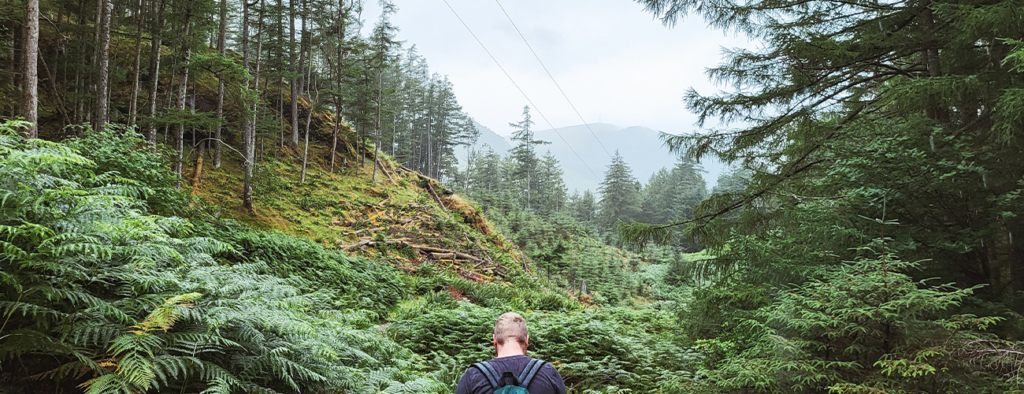
If you wanted to skip the walk but find Hagrid’s Hut, it’s roughly only 5mins from the car park – but I really would recommend the walk. This moderate circular route was my favourite walk of the trip, and a year on, still remains one of my favourite moments of our entire trip. There is a mixture of forest, short climbs, waterfalls, and atmospheric mountains that are simply breathtaking. The rain did not let up at all for this walk, but I loved it all the same! Here’s a photo of me looking over the location of Hagrid’s Hut:
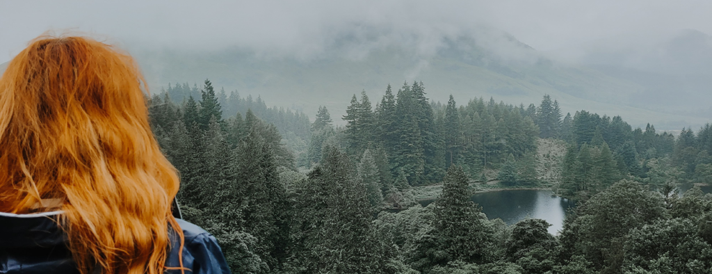
Breathtaking! Take me back now please!
Stop 22: Loch Tulla Viewpoint (23mins)
What3Words: tides.shuttered.risks
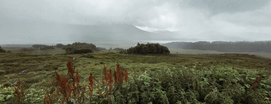
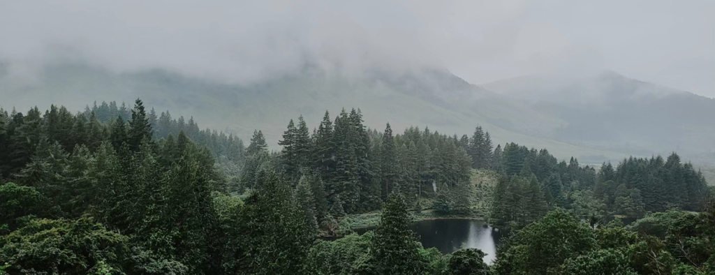
This is one of the smaller lochs that you pass if you are walking/driving along the West Highland Way and can be found close to Inveroran and Bridge of Orchy. The views from the viewpoint are amazing (even with the mist and fog we were experiencing), and there’s even a little pull up coffee stand if you want to appreciate the view with a hot drink and pastry. As the rain poured, I chucked on my rain coat and had a little moment with the scene that unfolded in front of me, whilst Scott and Gwen waited in the warmth of the van, appreciating the views from the front seat!
Stop 23: Artisan Cafe and Deli, Tyndrum (20mins)
What3Words: status.visitors.waggled
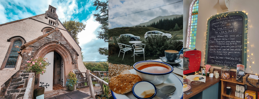
As the rain poured and we were feeling a little on the cold side, we decided to try our luck at an interesting cafe we found whilst on the road. As luck would have it, as we pulled up, we had a short break in the rain and were able to sit outside and enjoy a moment of sunshine with our lunch!
Artisan Cafe & Deli is a former deconsecrated church which has now turned into a small cafe and gift shop. It was a little gem that we found, and we ordered the soup of the day alongside some victorian lemonades and coffees, to warm up after our soggy walk earlier that day.
Stop 24: Killin (25mins)
What3Words: windmill.having.candles
We really enjoyed Killin. It’s a small village at the Falls of Dochart, which are a spectacular series of rapids that fall through the very centre of the village. Killin translates as Cill Fhinn ‘the White (or Fair) Church’ in Gaelic. The water gathers speed and falls more steeply as it heads towards Loch Tay, to become a very broad, rocky, series of rapids at Killin where it is crossed by the Bridge of Dochart.
In true Scotland fashion, the rain was once again pouring, so we had a slippery walk across the rocks of the waterfall (do take it easy if like us, you do this in the rain!!) before finding a pub for half a pint of cider in The Falls Of Dochart Inn. The pub literally looks over the waterfalls, but as it was pouring with rain, we chose to sit around the back under the safe heaven of a blow up globe! I must add, the food looked like proper home-cooked food with the smells of stews, pies and chips wafting from the kitchen. As tempting as it was though, we didn’t stay for food as we’d just had our wonderful soup!

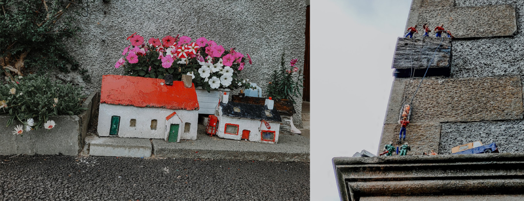
We also enjoyed a little wander around the village itself, taking in the lovely old brick homes and of course, we sampled the two gift shops there too (and bought some knic knaks for gifts!) When walking around the village, keep your eyes peeled as there are some little toy soldiers and toy workmen knocking around that you won’t want to miss amongst the pretty modes sized houses…
Stop 25 and our park-up for the night: Wanlockhead (2hrs 9mins)
What3Words: bars.nest.numeral
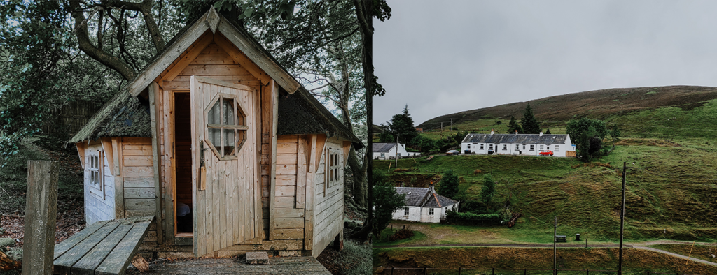
Did you know Wanlockhead is the highest village in Scotland? Nestled in the Lowther Hills, this former lead-mining village sits at an impressive 467 meters above sea level. Located near the head of the Mennock Pass and along the Southern Upland Way walking trail, it’s a place steeped in history.
I chose Wanlockhead for our final night because I managed to find a cabin to stay in—a little treat after three days snuggled up in the van with our soggy dog. Everything was starting to feel damp (and smelled distinctly of wet dog!), so we thought, “Bugger it, it’s our last night—let’s treat ourselves to a budget cabin!” And that’s how we ended up in Wanlockhead.
The drive there was an adventure in itself. As we wound through the hills, it felt like we were heading to the middle of nowhere. The occasional sheep or remote farm punctuated the landscape, but until we finally reached Wanlockhead, we weren’t entirely sure we were on the right track. By the time we arrived, the sun was setting, and mist was creeping over the hills, adding a slightly eerie atmosphere to the journey.
When we got to the village, we headed straight for the pub that owned the cabin we’d booked. Walking in and opening the creaky door, I felt every pair of eyes in the room turn toward me. It was a classic small-village moment, but the staff quickly broke the tension with their warm welcome and got us checked in.
The whole village had a charming, almost timeless quality to it, with a distinct “local” feel. Our cabin was simple—a bed, a bin, and not much else—but Gwen, our dog, was ecstatic, darting around like she’d discovered paradise. We, on the other hand, couldn’t help but glance wistfully at the van, laughing at how much we really had fallen in love with van life. It was so quiet around is, and whilst in the cabin, my partner kept jokingly whispering, “The hills have eyes,” which, despite being ridiculous, gave me goosebumps every time.
To cap off our last night, we decided to indulge in some pub grub. Naturally, we both went for the fish and chips, which turned out to be alright and did the job in filling us up. It was a budget stay, but we had a dry and warm night sleep in an interesting setting.
Day 6 total time: 3hrs 22mins (148miles)
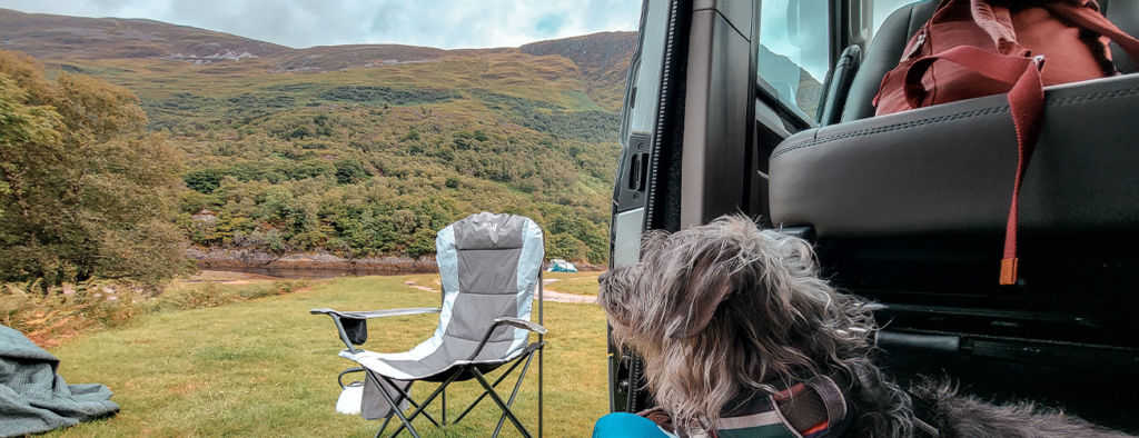
And that, my friends, wraps up our very first van life adventure—and what a place to kick it off: Scotland. Even a year later, I look back on this trip with so much fondness. Flipping through the pictures and videos still stirs those little dragonflies of excitement in my stomach, making me ache to return to Scotland’s breathtaking landscapes.
If you enjoyed my itinerary, don’t miss the chance to check out my YouTube video of the trip here. Since this adventure, we’ve completely fallen in love with the van life lifestyle and are now on the hunt for a van of our very own. So, stay tuned—this is just the beginning of our van life journey, and there’s plenty more to come!
Have you been to any of these spots? Which ones were your favorites? Or do you have any recommendations for our next visit to Scotland? I’d love to hear your suggestions in the comments.
If I had to sum up Scotland in two words, it would be this: ruggedly wild.

2 Comments
phill Braisby
What a lovely read Rose and a great adventure you didn’t mention contacting me saying you don’t think you will live through the night in that village pub 😀🍻 but it was a good laugh here xxx
theregoesrose
paha – I completely forgot I called you from our cabin! It was a good laugh and an interesting way to end the week!